Site 3 - Forest Marble
|
After leaving site 2, turn right and carry on along the path towards the Folly. You will pass the gate at the top of the steps leading down to
a lower level. (GPS N 51o23.699' W 002o17.814').
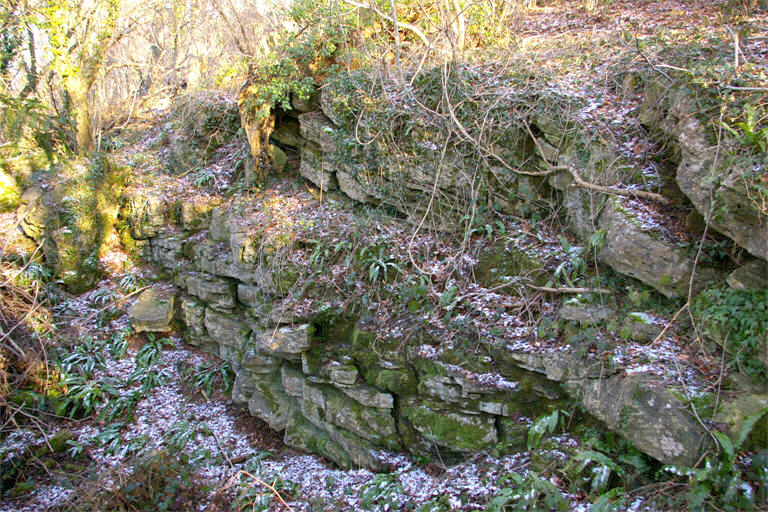
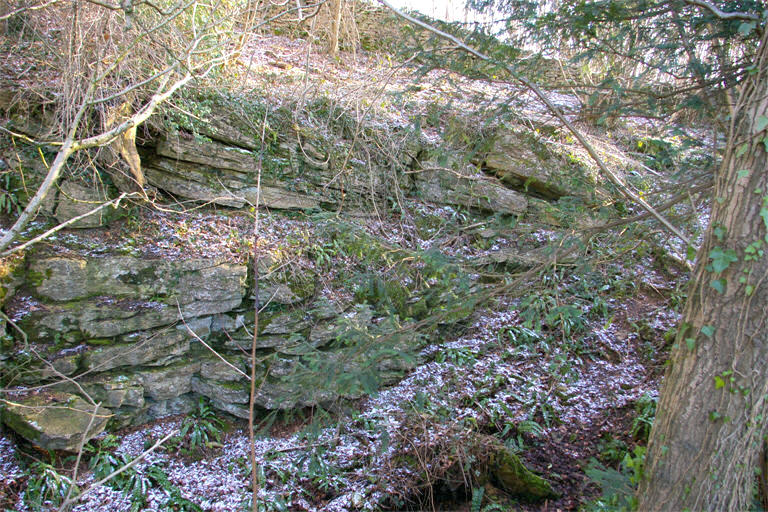
A little further along the path, (GPS N 51o23.676' W 002o17.800') notice the wall on the left hand side marking the boundary of the reserve; it has been built from blocks of Forest Marble. Examine these blocks in situ. You will see shelly lines picked out by differential weathering of the surfaces. Some blocks show lines cutting across at an angle indicating cross bedding in the block. Just before reaching the Folly, rocks of the Forest Marble can be seen forming the cliff edge. From this viewpoint it can be seen that the surrounding hills are all flat topped and of approximately the same height. The upper members of the Great Oolite rocks form the cap of all these hills. To the west, across the valley in which the Avon, the Kennet and Avon canal, the road and railway run, is Bathampton Down, on which some of the University buildings can be seen. From this hill, large quantities of Bath Oolite have been mined in the past, the stone being transported down to the canal by a tramway. Notice that there is some evidence of landslip of the lower part of the hill above the road. This has occurred in the Fuller’s Earth, a clayey formation that forms the lowest part of the reserve. The uneven nature of the hill between the road and the canal is largely the result of a landslip that occurred after considerable material had been tipped there. The movement of the slip was sufficient to breach the canal. Continue along the footpath past the Folly (GPS N 51o23.593' W 002o17.783') for about 100m and then turn down past a large hollow on your right and walk towards the blue-topped marker post 3.(GPS N 51o23.557' W 002o17.777') The rocks at site 3 show large-scale cross bedding in the Forest Marble and consists of several units with beds sloping in different directions. This type of structure is characteristic of much of the Forest Marble seen on the reserve and it is thought that it results from deposition of sediment in a tidal delta. A marker post indicates the path to Site 4. Care is needed here as Site 4 is a large hole in the ground. |
|